


Capcir Bouillouses-Camporeills

UDGI54
User
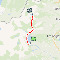

Length
10 km

Max alt
2248 m

Uphill gradient
335 m
Km-Effort
13.7 km

Min alt
2004 m

Downhill gradient
103 m
Boucle
No
Creation date :
2019-01-15 20:35:23.858
Updated on :
2019-01-15 20:35:23.858
3h28
Difficulty : Easy

FREE GPS app for hiking
 SityTrail
IGN / Geographical institutes
SityTrail Plus
The world is yours!
About
Trail Walking of 10 km to be discovered at Occitania, Pyrénées-Orientales, Les Angles. This trail is proposed by UDGI54.
Description
Tour du Capcir Barrage des Bouillouses au refuge des Camporeills
Positioning
Country:
France
Region :
Occitania
Department/Province :
Pyrénées-Orientales
Municipality :
Les Angles
Location:
Unknown
Start:(Dec)
Start:(UTM)
418207 ; 4712451 (31T) N.
Comments